Project Leader: Yong Huang
Group Members: Zhongping Zhang, Juping Chen, Zhibo Wu, Haifeng Zhang, Pu Li, Wendong Meng, Si Qin, Huarong Deng, Kai Tang, Zhien Cheng, Mingliang Long.
Research topics
1. Improvement of Satellite Laser Ranging (SLR) techniques both in ranging accuracy and system automation.
2. Applications of SLR techniques mainly to:
·The monitoring of movements of the Earth’s center of mass, and temporal variations of the gravitational field.
·Time transfer by laser pulses between satellites and ground stations, and among distant ground stations worldwide.
Status of the SLR System at SHAO and Changchun Observatories
Ranging precision : Single shot 10-15mm(rms)
Normal point 5-8mm
The SLR system at SHAO first achieved 7-8mm(single shot rms) with a pico-event-timer in August of 2001.
Maximum ranging: 20000km
Data quantity from routine observations:
The Chinese SLR Network
Consists of 5 fixed stations: Shanghai,Changchun,Beijing,Wuhan and Kuming; and 2 mobile stations.
Observing plans, technical standards, and technical upgrades are coordinated by SHAO.
The data analysis center is located at SHAO.
SHAO publishes Lageos data analysis reports weekly on the web. SHAO is also involved in carrying out SLR data analysis for research on astro-geodynamics and geodesy.
The international SLR network
There are presently about 50 SLR stations around the world, and the International Laser Ranging Service (ILRS) was established in November of 1998. The Central Bureau of ILRS is located at NASA/GSFC.
The scientific applications of SLR techniques
Determination of the geocentric coordinates of SLR stations worldwide, and establishment of a global terrestrial reference frame.
Measurement of the baselines between SLR stations, their variations, and the monitoring of crustal movements.
Measurement of the gravitational field of the Earth, variations in its center of mass, and determination of the Earth’s rotational parameters.
Accurate determination of the space positions and orbits of satellites, and to give support to a range of scientific satellite missions.
The SHAO and Changchun SLR stations have participated or are participating in the following projects:
Domestic projects:
National climb project in basic research “Modern crustal movement and geodynamic research”, 1992-2002
National key project “The crustal movement observaion network of China ”, 1997-2001
Development of the laser reflector array for the Shenzhou orbital module and laser ranging experiment, 1999-2003
Development of the reflector array for the Shenzhou orbital module
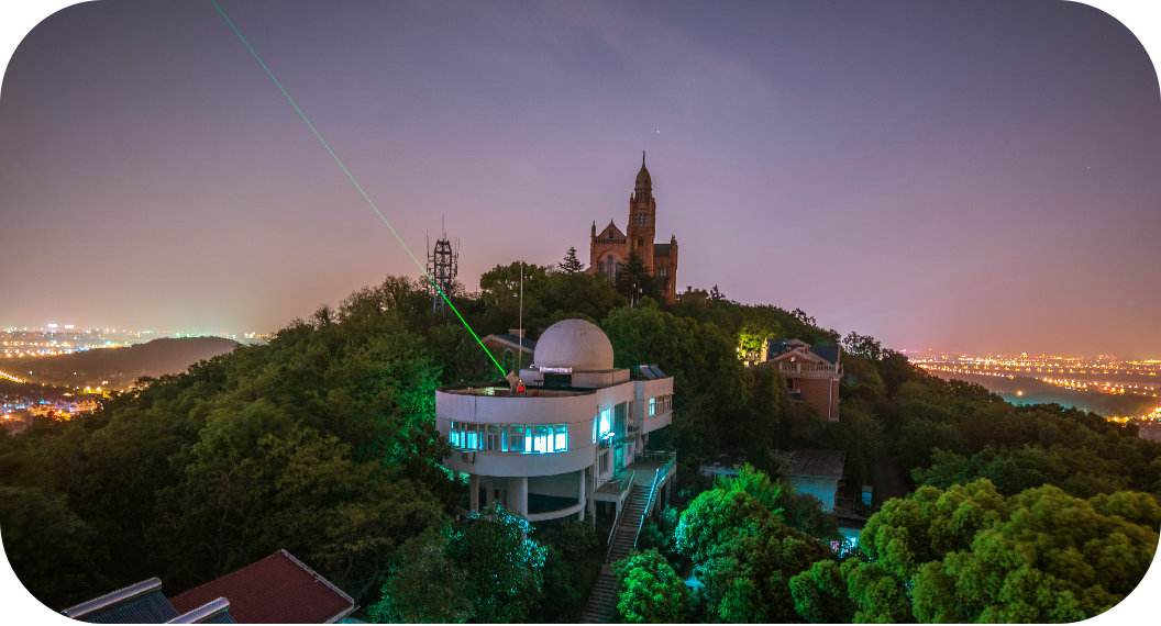
上海天文台60cm口径卫星激光测距站
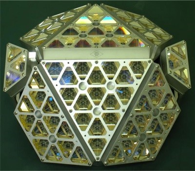
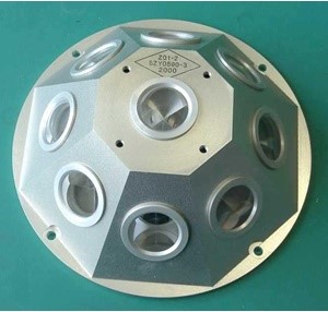
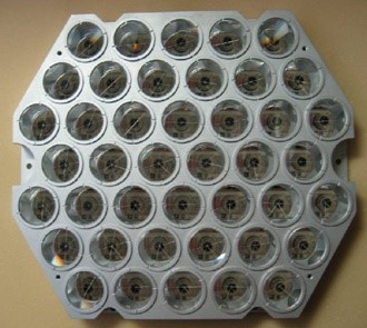
上海天文台研制的卫星激光反射器

